Visit the WWF narwhal tracker
November 13
Two of the narwhals have struck out fast along the coast, now off Auyittuq National Park in southeast Baffin Island.
But the sea ice is way further north – well behind the seasonal norm in the past 30 years. There is likely a lot of latent/residual surface heat in the water column. Maybe killer whales are still in the area. Maybe the narwhal need to get to the best area to feed on turbot ?
All posts by user
Tracking narwhals – October 2012
Visit the WWF narwhal tracker
October 22
With so much latent heat still in the water column, the Arctic sea ice is slow in reforming again this autumn. Our 4 narwhal with radio transmitters still working are moving fairly slowly SE along the North Baffin coastlines. Only the inner reaches of Eclipse and Tremblay Sounds, Milne Inlet etc have started freezing, and there are large expanses of open water well to the north still. I wouldn’t expect our 4 whales to really start moving fast to the wintering areas until the temperatures drop substantially. Pond Inlet air temperatures this week are still in the zero to -10C range, quite warm still, really!
October 10
Now that people are mainly back at their homes, labs and offices, we can start sharing the summary results and weekly updates from the August narwhal tagging work WWF was proud to be able to support in the north Baffin region!
This August was a very different one from 2011 – local say that this was “the summer that never came”! The narwhal were there certainly, in Tremblay Sound and areas near Pond Inlet and Arctic Bay, but they certainly behaved very differently, as the windy, rainy, and gray weather dominated every single day it seemed.
In the 2 weeks we were there we caught 5 narwhal, and fitted them with Argos satellite radios – one seems to have malfunctioned or fallen off within the first few weeks, so we display the weekly updates now on the adjacent map, for the 4 animals (2 are males, and 2 are females). This year we’re able to give a small profile of the individual animal – sex, length, and even a nice mugshot/the radio when fitted.
Although there were far fewer bird species than in the same period last august around the Tremblay Sound camp, the daily rain/deluge this year was great news for plant life – many species that hadn’t flowered in 2011 august camp were carpeting the low tundra ‘garden’ beside our camp this august. We were also treated to almost daily visits by up to 4 polar bears and 5 arctic foxes, and a few narwhal carcasses along the coast provided much welcomed food for these bears and probably other scavenging foxes.
Right now, we know that narwhal 01 (tag #115959, a 4.4m male) moved quickly west into Admiralty Inlet, after tagging in mid-August, and remained there for September. It seems now to be slowly edging eastwards, catching up with the other 3 animals, heading east before the winter sea-ice starts forming fast from the shoreline outwards. In early October now, the region now has routine sub-zero temperatures, with overnight lows at -10C or lower, so sea ice will start to reappear soon., and we can expect the narwhal to keep heading steadily along their continental shelf migration corridors towards the wintering areas, where they will feed at much greater depths for much of the winter.
Climate change shapes polar bears’ past… and future

© Eric V. Regehr / USGS
Change… Following on the well-traveled path of the Greek philosopher Heraclitus and others since, Isaac Asimov once said:
“It is change, continuing change, inevitable change that is the dominant factor in society today. No sensible decision can be made any longer without taking into account not only the world as it is, but the world as it will be…”
Alternatively – change is the only constant.
The planet we call home has been changing since it all began some four billion years ago. From the formation of our current atmosphere to the position, shape, and size of the continents that support us, change has indeed been a constant. Therefore, while the world is certainly a very different place today than it was say a thousand years ago, the questions that haunt us now have to do more with the rate, magnitude, and drivers of that change. Answers to those questions are providing some troubling, if not alarming, data regarding human driven changes. Some scientists have even coined a new term for our current era: the anthropocene: the time when human activities became the dominant drivers of key global systems and biodiversity.
Nowhere are these questions more acute, and the transformative affects more apparent than in the Arctic, a region that is warming at more than twice the global average. The face of that change for many is the iconic polar bear. A warming Arctic is rapidly eroding the very sea ice that polar bears need to be- well- to be polar bears as we know them today. While polar bears have clearly survived warming events in the past, there is no reason to infer the bears we have today will be as fortunate. A host of scientific research has clearly laid out those concerns and the measurable impacts of warming to date on some management units like Western Hudson Bay. However, some new observations of hybrid bears in the wild and fresh data on polar bear genetics have some people asking questions.
First, let’s look at the important recent genetic study (overview | original study) that resets our collective understanding of bear evolution and relatedness. This paper was several years in the works and required the collaboration of many scientists from around the world. It will not be the last word on polar bear evolution, but it provides a significant new dataset and several new hypotheses that reshape our understanding of this species. The essence of this first full look into the polar bear genome is that they split from a common bear ancestor with brown bears much longer ago than currently thought (up to 4.5 MYA) and that the two are sister species that have interbred historically. Polar bears likely co-evolved with brown bears, but did not evolve fromthem as previously thought. Researches also theorize that past changes in climate likely brought these two species into closer proximity that allowed for this hybridization. While some of their genes may carry on through cross breeding, there is no reason to believe the animals we know as polar bears would endure.
Genetic data also suggest that polar bears occur in much smaller numbers today than in prehistory. There is also no evidence that early polar bears resemble the highly specialized animals we know today. These historical population estimates appear to track changes in climate, showing a long-term decline in numbers since the last ice age. One result of this decline is that polar bears likely possess far less genetic diversity today than they had historically, making them more vulnerable to recent and projected changes.
At the end of the day, whether polar bears are 150,000 years old or 5 million, in the face of current persistent and rapid climate warming, the world around them (and us) will be unlike anything they have experienced by the end of this century, if not earlier.
Final thoughts from dry land
For two nights after I got off the boat, I woke up in the middle of the night to a swaying bed. It took me a while in my sleepy state to work out that I was in fact no longer on the boat, but on dry land.
Then just over a week after getting off the boat, the queasiness returned. This time it was not caused by phantom boat rolling, but by the news that we had already broken the record for low sea ice extent in the Arctic.
This was not quite the end of August. The low sea ice extent in the Arctic usually occurs closer to the end of September, so it’s likely that we will continue to set new records for minimum sea ice extent over the next few weeks.
We needed to see it not just on satellite maps, but more as local people do – from the shores of their communities, from their boats, from their hunting camps.
A significant part of our ongoing project to help map out a future for the last ice area consists of consulting with the people in communities around the area. This is their back yard, and what they have to say about it matters. We had hoped to be able to observe Arctic wildlife to take photos and moving images to show people the rich diversity of life in this sometimes bleak and barren looking area.
In this we were often disappointed – sometimes we would catch tantalizing glimpses of something, only to have it move away, or for the weather to force us away. Finally, on the last leg, life at the ice edge partly revealed itself, in the shape of a small herd of muskoxen, a pod of narwhals, and a herd of walruses.
We also managed to contribute in a small way to the research that needs to be done in the area. Sampling salt marshes and seawater for evidence of what life lives there now will help in assessing how the area changes, and in helping project how it is likely to change.
On the way back from the boat, I flew to Resolute Bay to Iqaluit next to a professor from Colorado – he is an oceanographer who had been aboard the coastguard ship the Larsen, and scientists working with him had the opportunity to sample the water in the fiord in northern Greenland where a massive ice shelf, twice the size of Manhattan, has recently broken off. He believed this area of water had been under ice since the industrial revolution.
That is the challenge we face – a vast area, little visited, little researched that is changing so quickly and so radically. Our visit there was a snapshot – our engagement there in the coming years must deepen both our knowledge, and the world’s knowledge of this increasingly important place.
The end of the voyage
I’m writing this blog from Iqaluit, after a day of travel and transition, following the conclusion of Leg Three of the Sailing to Siku voyage. It was with a tinge of sadness that we left the Arctic Tern to make our respective ways home, although it’s nice to no longer be confined to the cramped sleeping and galley spaces on a 47ft boat. I still have a large bag of suspicious laundry and a lingering taste of sea brine in my mouth, but my feet are firmly planted on shore.
It’s too early for a definitive assessment of the trip but I can offer a few observations from my own perspective. First of all, the biggest impression I got from traveling through this region by boat is its massive scale. After two weeks, we saw only the south-eastern tip of Ellesmere Island, a short stretch of Devon Island and we barely scratched the northern tip of Baffin Island. Even the comparatively ‘tiny’ Bylot Island is positively endless when you’re sailing along its coast at 6 knots.
We saw fewer whales than I’d anticipated. There are tens of thousands of narwhal in the region, as well as healthy populations of beluga and bowhead and reported pods of aggressive orcas, but very few came within sight of our boat. Partly that’s due to the sheer vastness of the waters – there’s lots of room for whales to hide. And perhaps they were avoiding the sound of our motor.
If we saw few whales, there was definitely more ship traffic than we’d anticipated. We encountered several ships over the two weeks of our trip – in Resolute Bay, Admiralty Inlet, Nanisivic, Navy Board Inlet and Pond Inlet. Most were involved in the critically important sealift resupply of Arctic communities, while the ships in Pond Inlet were part of Canadian Navy and U.S. Coast Guard maneuvers/public relations. It’s not a lot of traffic when compared with major shipping routes, but it’s a significant indication of the growing interest in and use of Arctic waters. We were given a tour of the Terry Fox in Nanisivc, with its Polar Class 4 icebreaking capabilities, which allows it to bring supplies to communities that ordinary commercial ships are not qualified to sail in. But as the demand for shipping services grows – and as the reach extends north into increasingly ice-free waters – it will become increasingly important to manage this growth carefully, and ensure that ships adhere to the best and safest practices.
I look forward to seeing the results of the phytoplankton samples that our on-board researcher Sophie took in the middle of Jones and Lancaster Sounds. There’s a lot still to learn about this region, starting at the base of the food chain.
We were graciously received by the people in the communities we visited, starting in Grise Fiord, with a mid-trip stop in Arctic Bay and concluding our leg in Pond Inlet. Many of the most experienced hunters were off on the land (or water), demonstrating their skills in securing abundant food and other necessities in this awe-inspiring environment, but we look forward to returning to continue and build on these initial discussions about future aspirations for the region. And with Vicki Sahanatien now ensconced in WWF’s Iqaluit office, we’ll have opportunities to continue that dialogue.
Lastly, I was impressed and deeply grateful for the skill, hard work and good humour of our crew. Grant, Pascale and Valentine did an outstanding job of keeping us safe and on course. Together with my other ship-mates – Ed, Sophie and Vicki – we collectively fostered a spirit of camaraderie that more than made up for the cramped living quarters and other inconveniences of seafaring on a small boat. Thanks to all of you!
Too many narwhals to count

A narwhal (Monodon monoceros) surfacing for breath in the Arctic, Canada. © WWF / Paul Nicklen, National Geographic Stock
My last watch on the Arctic Tern 1 was from 2-4AM on August 30. I was on deck with Pascal, first mate. We were motoring the sailboat into Eclipse Sound, there was no wind, the ocean completely calm. We glided through many fog patches, straining our eyes in the half darkness searching for growlers and ice bergs. A few seabirds were active even at this time of night, including the occasional dovekie, the smallest seabird in the Canadian Arctic. At some point during my watch the almost full moon rose, its light diffused by the fog.
We noticed some ripples on the port side – seals? Then more ripples with the arch of a surfacing whale – narwhals! We watched them pass, traveling in the opposite direction. Too many to count, better to enjoy the encounter. Eclipse Sound is well known for its large population of narwhal. WWF has partnered with the Pond Inlet Mittimatalik Hunter and Trapper Organization and the Department of Fisheries and Oceans to study narwhal. For the past two years satellite tags have been attached to narwhal to study their movements. Narwhal are a sea ice associated species. Unlike the beluga and orca, narwhal remain north in Baffin Bay throughout the winter, feeding amongst the pack ice floes and leads. A resident species of the Last Ice Area.
Lancaster Sound, past, present and future
By the time of my 11pm shift on watch we were well up towards the mouth of Admiralty Inlet, sailing into a light headwind through dark and foggy skies. Night-time darkness has been a relative rarity on this trip, but at this time of year the days are growing shorter at a rapid rate. Steering a steady course under these conditions is considerably more challenging, since there are no landmarks to serve as guideposts. Instead of being guided by a landmark, it was necessary to be guided by the wind, which proved considerably more difficult for a landlubber like myself. Unused to the slow response to direction changes from the helm, I found myself continually oversteering, and zigzagging back and forth. Grant, our captain, patiently guided me in developing the right touch, and anticipating the changing orientation of the boat, the sails and the wind. With some practice, I gradually managed to reduce some of the wilder swings of direction, but have a long way to go before I can claim genuine competence in this regard.
The low visibility compounded the challenge of avoiding the “bergy bits” and “growlers” – fragments of icebergs that, although small, are nevertheless best avoided. When you’re in a small boat in a cold ocean and many hours away from any possible rescue, the last thing you want to hear is something crunching against the hull. All in all, despite the flat homogeneity of the terrain, it’s very difficult to fall asleep at the helm; there’s always something to watch out for.
My next shift was at 7am, and by then we were in Lancaster Sound, sailing through waters that were flat calm. Lancaster Sound was failing to live up to its fierce reputation. We were sailing on autopilot and my task was the relatively simple one of spotting and avoiding the occasional pieces of ice.
I had the time to think about where we are. Anyone who has gone through the Canadian school system will have heard countless stories about the search for the Northwest Passage and its role in the European colonization of this vast continent. Lancaster Sound is the eastern opening of the Northwest Passage, although it took numerous voyages to establish that it would prove necessary to cross over the top of Baffin Island, since Hudson Bay offered no practical western passage.

Two narwhal (Monodon monoceros) surfacing to breathe in Admiralty Inlet, Lancaster Sound, Nunavut, Canada. © Paul Nicklen/National Geographic Stock / WWF-Canada
Lancaster Sound is a vast channel, more than forty nautical miles wide, and must have been a formidable challenge for Inuit hunters to cross on foot or by kayak. However, it was attractive to these rugged hunters since it’s abundant in whales, especially the legendary narwhal (although they’ve proved elusive to us!).
Today, Lancaster Sound is the site of a proposed National Marine Conservation Area. Further research and consultation with local communities will be required before this conservation area is formally established, but it will provide important protection for the narwhal, beluga and bowhead whales that spend their summers here. Moreover, Lancaster Sound could provide the southern foundation for a vast multi-zoned complex of special management areas, aimed at conserving ecosystem resilience in a rapidly changing Arctic environment. While summer sea ice disappears from much of the Arctic, and the period of annual ice cover shrinks dramatically, the high Arctic of northern Canada and Greenland – the ‘Last Ice Area – is likely to become increasingly significant in providing secure habitat for ice-dependent species. Conserving this habitat – while allowing for responsible development – provides Nunavut and Greenland with a unique opportunity to demonstrate Arctic stewardship.
Arctic Bay, Nunavut

Arctic Bay, Nunavut. © Students on Ice / WWF-Canon
By Martin von Mirbach and Vicki Sahanatien, members of the Last Ice Area voyage
It took 24 hours to sail from Devon Island to Arctic Bay on northern Baffin Island. We crossed Lancaster Sound and entered Admiralty Inlet under good wind and sea conditions. Admiralty Inlet opens southeast off Lancaster Sound, separating the Borden and Brodeur Peninsulas. We sailed partway down the inlet before turning into Adams Sound and then into the perfect sheltered harbor of Arctic Bay.
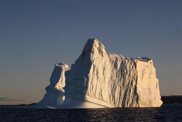
Icebergs appeared and disappeared as we sailed but the star attraction of the crossing was an ice island – a large flat shelf of ice several kilometers square. We found out later from the ice observer on the Coast Guard ship Terry Fox that it was a fragment of the huge ice island that calved off the Peterman Glacier of northwestern Greenland in 2010.
Arctic Bay was our first community since leaving Grise Fiord a week ago. It was time to resupply with fuel, water and fresh meat, fish, fruit and vegetables. We also took this opportunity to meet people in the community to learn about the latest news.
We stopped by the Hamlet office and found that Clare Kines, the Economic Development Officer was at his office at the Heritage Centre. So off we trekked to find Claire and learn about Arctic Bay’s economy. Arctic Bay is a medium sized community, with about 800 people. It is a community in transition, since the Nanisivik mine shut down several years ago. Arctic Bay and Nanisivik were connected by Nunavut’s only road and by employment, recreational activities and family. Some of the skilled workers are still without local employment. The future? People look toward the proposed Mary River iron ore mine and potential opportunities that will arise.
Next, it was the offices of the Ikajutit Hunter and Trapper Organization (HTO), where we met Jack Willie the HTO office manager. Here we heard details of the successful bowhead whale hunt. Arctic Bay hunters brought in their bowhead in record time: 35 minutes from harpooning to towing the whale into shore. We had hoped to meet the hunt captain, Tommy Tatuapik but he was out of town. It was also narwhal hunting season. One of the hunters dropped by with two narwhal tusks for the HTO manager to measure and register. HTOs manage the community narwhal quota by allocating tags to the hunters. The narwhal hunt, like all quota limited hunts in Nunavut, is regulated by the Nunavut Wildlife Management Board and the responsible federal or territorial department.
Other encounters in the town were more informal. Each time our zodiac came ashore we were greeted by a band of children, who were curious about our boat and asked to be taken aboard. Two zodiac loads of kids came to the Arctic Tern and they were fascinated by the differences between a sailboat and the motor boats of Arctic Bay.
Crossing Lancaster Sound
By Martin von Mirbach and Vicki Sahanatien, members of the Last Ice Area voyage
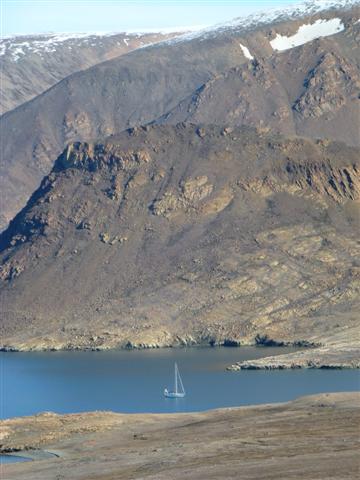
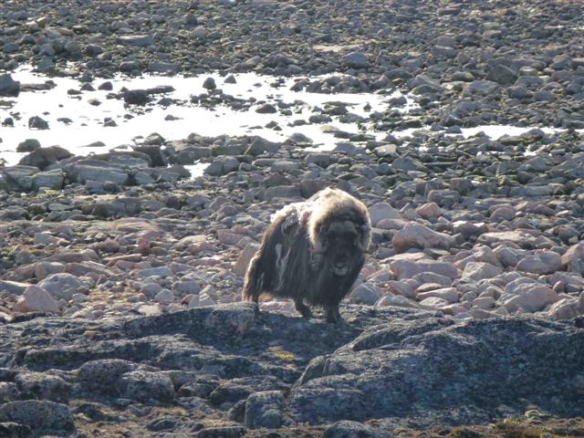
For the past few days we’ve been exploring Lancaster Sound, the eastern entrance to the Northwest Passage. Our first sheltered harbor was in a protected bay on the southeastern corner of Devon Island. A short shore walk took us to within close range of four muskox, but our arrival was noted with some displeasure before the biggest male of the group “walked us off” his property in no uncertain manner.
Wildlife were not the only occupants of this perfect harbor. In the 1940s this was the site of the Dundas Harbour RCMP post. The post buildings still stand and remain remarkably sturdy. Stone walkways link the buildings and lead the way to the nearby cemetery where two RCMP officers were laid to rest. Inside the main post building is a written commemoration to the young officers who manned the post.
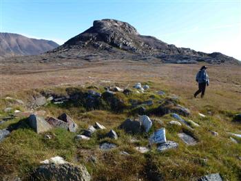
People have used Dundas Harbour for many centuries. Prior to the RCMP, Inuit camped and hunted here. 20th century and recent tent rings dot the shoreline and raised beaches, as well as evidence of ancient human use – the Thule. We found three Thule sod houses, intact with the bowhead whale bones that were used to construct the houses. We marveled at this evidence that many centuries ago the Thule hunted 70 tonne bowhead whales using kayaks and harpoons. Seeing these sites demonstrates that this region, like much of the Canadian Arctic is not and never was uninhabited wilderness.
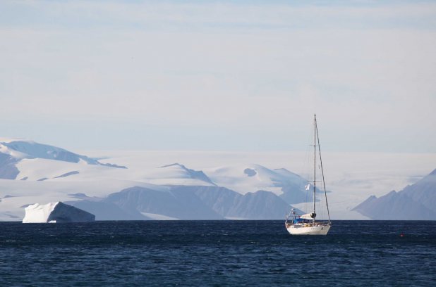
Taking advantage of the continuing stable weather, we set sail that evening along the southern coast of Devon Island, The waters are almost entirely ice-free, except for the occasional iceberg, some of which are large and magnificent.
Devon Island, Nunavut
We sailed the Arctic Tern I overnight from Cobourg Island to Queen Aba Harbour on eastern tip of Devon Island. The wind was light but sufficient to sail until sometime after midnight – the wind dropped off and we had to make use of engine power. Jones Sound was free of sea ice but there were many icebergs to be aware of as we sailed. Icebergs are not sea ice, but the progeny of glaciers that reach into the sea. The icebergs we sailed by may have been locally generated, as there are many glaciers that dip their toes into the ocean
on southern Ellesmere Island and Devon Island, or they may have originated in northwestern Greenland.
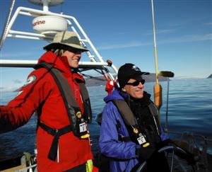
When sailing overnight we take 2 hour shifts on watch with the Captain or one of the mates. We assist by watching for ice, checking the navigation equipment, and steering the sailboat. As we work, each of us takes in the extraordinary beauty of the sea and adjacent islands. The sunset last night but just dipped a bit below the horizon, which meant we did not experience darkness, just a lower level of light. 24 hour daylight! Its presence permits us to continue exploring the most easterly part of the Last Ice Area around the clock.
Sea birds keep us company as we sail: thick-billed murres, black guillemots, glaucous gulls, and the most plentiful, northern fulmar. The fulmars appear to enjoy our company too, as they fly close by the sailboat: coming alongside, zooming past the bow and stern. We keep an eye out for the rare Ivory Gull as we travel. Our marine mammal observations have been sparse, with a single walrus checking us out at lunch while we were anchored in Queen Aba Harbour, and ringed seals popping up as we sail. We just began our 2nd overnight sail, heading to Lancaster Sound. Our route will follow the southern shore of Devon Island on our way to Arctic Bay. The upcoming waters are known for their rich biodiversity and we anticipate observing whales, walrus, seals, polar bears, and many more seabirds.
